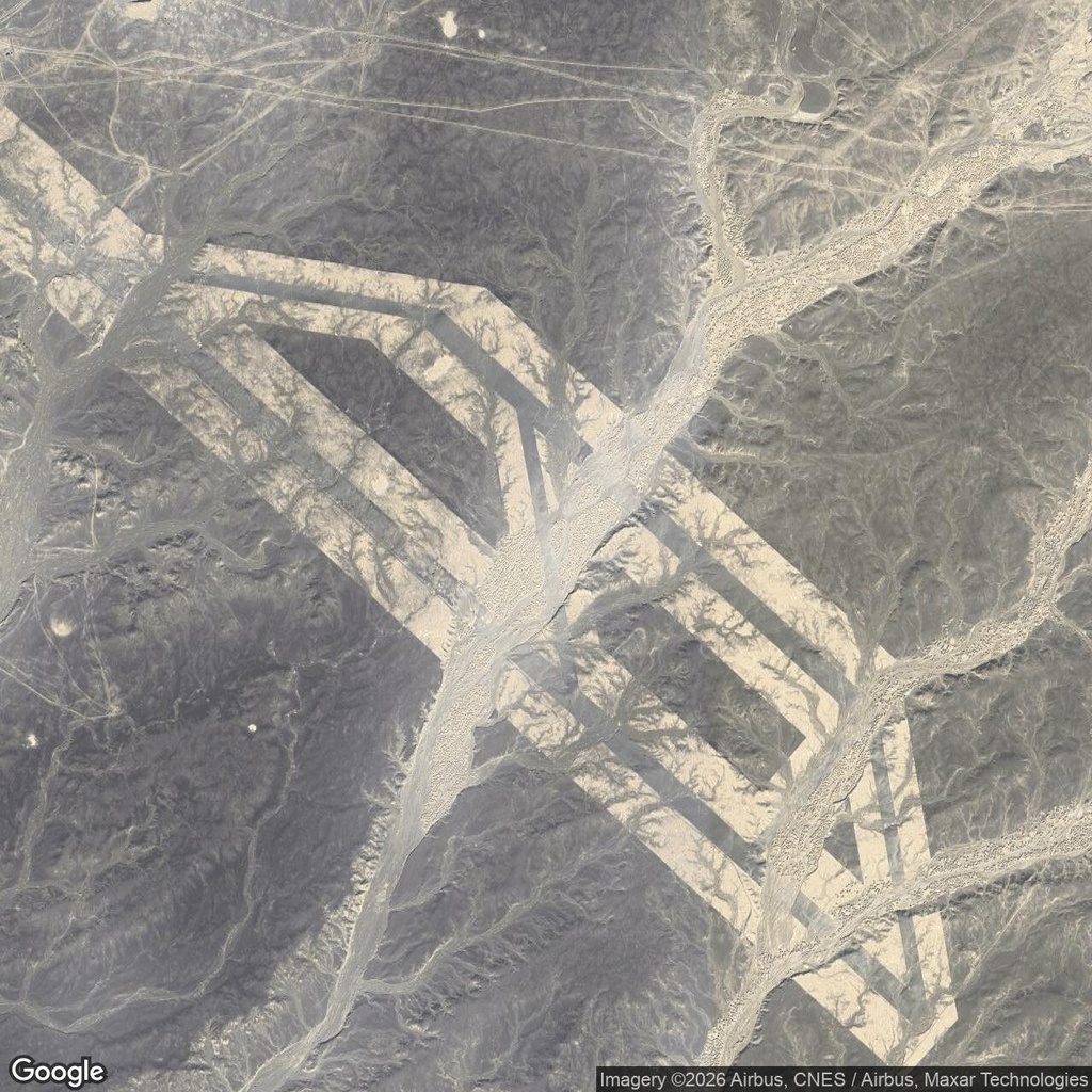
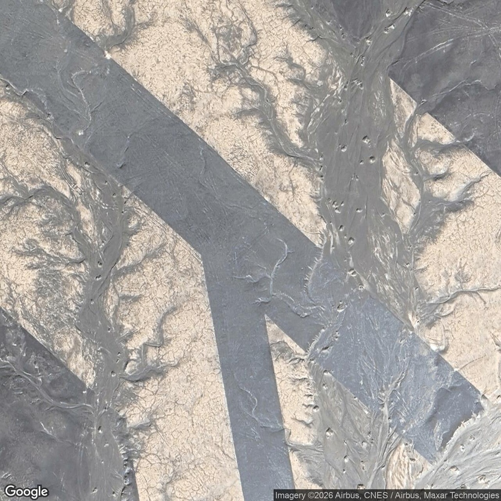
At first glance, the long parallel strips suggest an airfield. Then a broad drainage channel cuts straight through them. Angular connectors join the strips, small pits interrupt their surfaces, and branching erosion marks spread across the pale ground.
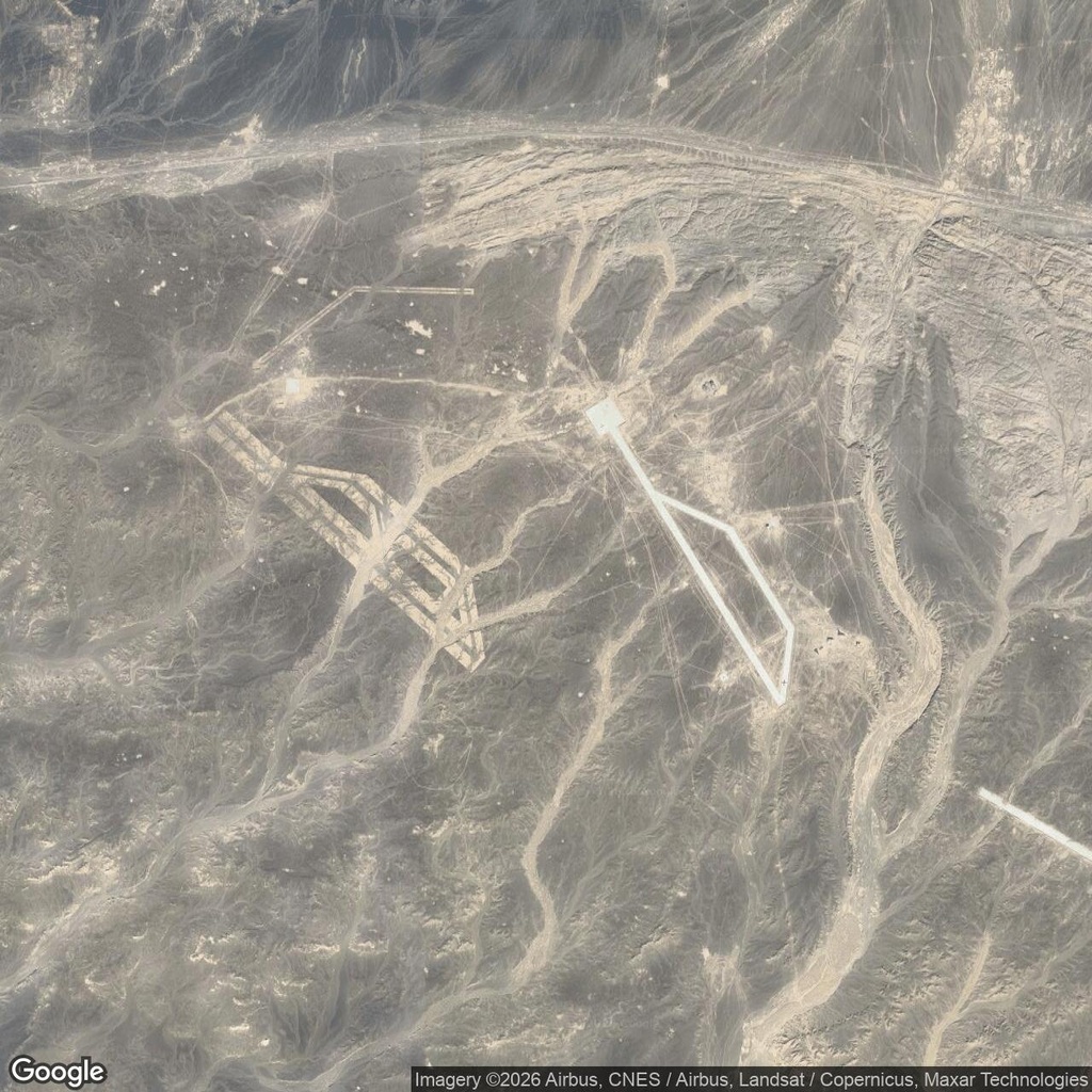
This runway-like pattern lies in the desert northwest of Dunhuang, China. The wider satellite image reveals a second, brighter outline nearby, with two long sides and angled connections. Together, they resemble simplified airfield layouts, although we have not verified that aircraft ever used either site.
Runways built to be targets?
These features were already attracting attention in August 2009. A Google Sightseeing article illustrated both layouts and questioned the apparent lack of supporting buildings and access roads. Its author also pointed to apparent bomb craters near one runway and raised the possibility that these were fake airfields built for aerial bombardment practice.
We have not found an official identification, a construction date or a verified account of aircraft operating here. The target explanation is plausible, but remains an interpretation of the imagery.
A neighbour of the Gobi zigzag grid
Approximately nine kilometres west-southwest, measured between the map pins, lies the Gobi Desert zigzag grid. Its broad pale lines divide a rectangular area into irregular polygons.
The contrast is worth exploring. The grid spreads its markings across an area; this site concentrates them into long strips and angular junctions. Both are conspicuous constructions in the same desert landscape, but proximity alone cannot tell us whether they belonged to the same project.
Comments:
No comments yet.